THE NATIONAL SITUATION
Data shown here were retrived from the historical database on landslide and floods known as the
AVI project. The databse contains 17186 information on landslides and 7178 information on floods occurred in Italy from 1918 to 1990. Information refers to more than 15,000 sites of which 9069 were affected by landslides and 6440 by inundations. There are 2578 sites afftected by landslides and 2283 sites accected by inundations recursively (i.e., more than once).
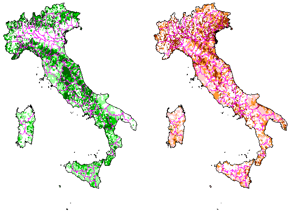
66.8% of all italian municipalities are konown to be affected by eather a landslide (47.6%) or an inundation (42.7%). For 22.4% of the municipalities information on both landslides and floods are available. For 2612 townships the historical archive does not contain information on any catstrophic event.
 On the left, in shades of green, municipalities affected by landslides for the period 1918-1994. On the right, in shades of red, municipalities affected by floods for the same period. Darker colours indicate a larger number of sites.
The maps do not represet the hydrogeologica hazard or risk. An enlargment of these maps is available here.
More historical information is available at the CNR-GNDCI Information System site.


