
|
Progetto AVI |
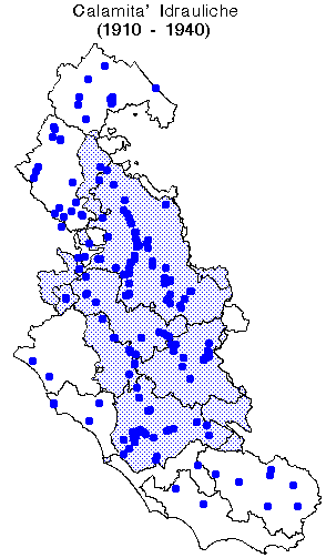
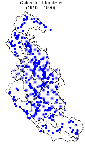
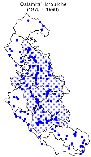
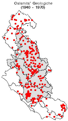
For the Tiber river basin in Central Italy, the AVI digital database was updated with the information collected from newspaper articles (S0) for the period 1920-1990. Data were tested for consistency and data redundancy. About 1000 information on floods and 1000 information on landslides were identified.
Information was stored into a geographical information system for data analysis and display. Maps showing the distribution of landslides and floods for the entire period or in three-decades intervals were prepared. The database can be used to access the spatial extent of damages for specific catastrophic events, as well as to estimate possible spatial recurrencies.
Maps showing the distribution of events on a municipality base are also
available.
![]() Floods
Floods
-
Distribution of floods for the period 1920-1990
Distribution of floods for the period 1920-1940
Distribution of floods for the period 1940-1970
Distribution of floods for the period 1970-1990
-
Distribution of landslides for the period 1920-1990
Distribution of landslides for the period 1920-1940
Distribution of landslides for the period 1940-1970
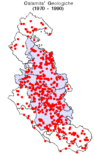
Distribution of landslides for the period 1970-1990
-
Distribution of floods and landslides for the December 1937 event
Distribution of floods and landslides for the December 1959 - January 1960 event
-
Frequency of all hydrological catastrophes
Frequency of landslides
Frequency of floods
![]()
![]()