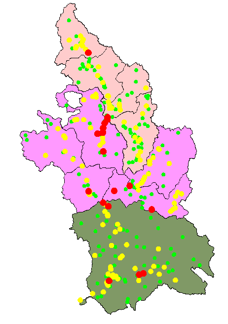
The map shows the spatial recurrency of inundations in the Tiber River Basin, the second largest river basin in Italy. Green dots are sites inundated 1 time. Yellow dots are sites inundated fron 2 to 10 times. Red dots represent localities inundated more than 10 times for the period 1918-1990.